

Introduction
If you've already read the altitude-and-latency summaries that dominate search results, you know the basics — and you know they don't get you very far when orbit selection has real engineering and operational consequences riding on it.
This guide is written for engineers, researchers, and systems decision-makers who need the comparative depth that those primers leave out: coverage geometry, radiation environment, station-keeping demands, ground infrastructure requirements, and how multi-orbit architectures are changing what the choice actually means.
The goal is a rigorous, side-by-side picture of all three orbit tiers — one that holds up under scrutiny.
TL;DR
No single orbit tier is universally superior — each represents a distinct set of engineering trade-offs, and the right choice depends entirely on the mission. Understanding why those trade-offs exist, across latency, coverage, radiation, propulsion, and ground infrastructure, is what separates a well-reasoned orbit selection from an inherited assumption.
This article covers:

Altitude ranges and orbital physics fundamentals
Coverage geometry and constellation size requirements
Radiation environment and Van Allen belt exposure
Station-keeping and propulsion demands by orbit
Ground infrastructure and link budget considerations
Space debris risks and multi-orbit integration
What Are GEO, MEO, and LEO Satellites?
The difference between a GEO, MEO, and LEO satellite is, at its core, a question of altitude — and altitude turns out to be the single variable from which nearly every other engineering and operational trade-off flows.
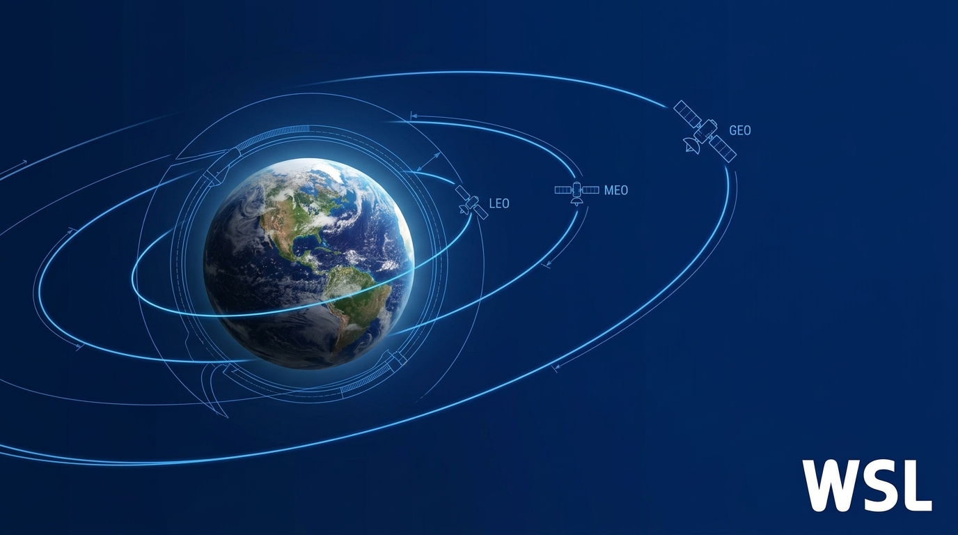
Low Earth Orbit (LEO) spans roughly 160 km to 2,000 km above Earth's surface. Medium Earth Orbit (MEO) occupies the broad band between LEO and GEO, with active constellations most commonly operating at 8,000–20,000 km. Geostationary Earth Orbit (GEO) sits at a fixed altitude of approximately 35,786 km above the equator.
These boundaries are not informal conventions. The ITU Radio Regulations provide the international regulatory framework that distinguishes orbit regimes, and the Inter-Agency Space Debris Coordination Committee (IADC) formalises protected-region definitions in its Space Debris Mitigation Guidelines: the LEO protected region extends to 2,000 km altitude, the GEO protected region covers ±200 km around 35,786 km, and MEO is defined as the region between them.
| Orbit | Altitude Range | Orbital Period | Orbital Velocity |
|---|---|---|---|
| LEO | ~160–2,000 km | ~90 minutes | ~7.8 km/s |
| MEO | ~2,000–35,786 km (typically 8,000–20,000 km for active constellations) | ~2–24 hours | – |
| GEO | ~35,786 km (fixed) | ~23 hours 56 minutes | ~3 km/s |
Key orbital parameters compared across LEO, MEO, and GEO. – not publicly listed.
The table makes the contrast immediate: LEO satellites move at roughly 7.8 km/s and complete an orbit in around 90 minutes, while a GEO satellite travels at approximately 3 km/s and takes nearly 24 hours to complete one orbit — yet appears motionless from the ground. MEO sits between these two extremes, with orbital periods spanning roughly 2 to 24 hours depending on altitude, and characteristics that shift considerably depending on where within the band a constellation operates.
The Physical Basis for Geostationary Orbit
GEO's defining altitude is not a design choice — it is a physical constant. At 35,786 km, the orbital period of a satellite exactly matches Earth's sidereal rotation period of approximately 23 hours 56 minutes, causing the satellite to remain stationary relative to any fixed point on the ground below.
This geosynchronous property is what makes GEO uniquely suited to applications requiring a persistent, fixed line of sight — such as fixed-dish broadcast and continuous weather monitoring over a wide area. No other altitude produces this effect for a circular equatorial orbit; 35,786 km is the only solution the physics permits.
LEO's boundaries are equally grounded in physics. The lower limit of approximately 160 km is set by atmospheric drag: below this altitude, residual atmosphere decelerates satellites rapidly enough to make sustained orbital operations impractical. The upper boundary near 2,000 km is informed by the inner Van Allen radiation belt, which creates a significantly more hostile radiation environment above that altitude — a factor explored in detail later in this guide.
MEO occupies the intermediate band, with operational constellations most commonly found between 8,000 and 20,000 km — GPS satellites, for instance, operate at a mean altitude near 20,300 km, well within the MEO band. With orbital periods that can range across much of the spectrum between LEO and GEO, MEO is neither the fast-moving, geometrically complex environment of LEO nor the apparently fixed vantage point of GEO, and that middle-ground character carries distinct engineering implications.
Other orbit types exist beyond these three primary tiers — including Highly Elliptical Orbit (HEO), Sun-Synchronous Orbit (SSO), and Molniya orbits — but this guide focuses on LEO, MEO, and GEO as the dominant classifications in satellite system design and regulation.
Every meaningful performance difference between LEO, MEO, and GEO — latency, coverage footprint, constellation size, radiation exposure, and ground infrastructure demands — is a direct consequence of how far the satellite sits from Earth's surface.
With the orbital framework established, the sections that follow examine each of these consequences in depth: how altitude determines propagation delay, coverage geometry, radiation environment, and the ground infrastructure needed to support operations across all three tiers.
Period, Velocity, and Latency: How Altitude Shapes Each Orbit
Three numbers — orbital period, orbital velocity, and propagation delay — follow directly and deterministically from altitude. Get those three numbers in view across all three orbit tiers and every engineering trade-off in satellite systems becomes legible: why some constellations need thousands of spacecraft while others need three, why some links can carry a voice call and others cannot, why ground antennas for one orbit type sit fixed on a rooftop while those for another demand continuous high-speed tracking.
Orbital Period: From 90 Minutes to 24 Hours
As established, GEO satellites orbit at 35,786 km — the precise altitude at which orbital period equals one sidereal day (23 hours, 56 minutes, and 4 seconds), matching Earth's rotation and producing the fixed apparent position that defines the orbit.
MEO spans a wide altitude range, and its orbital periods reflect that spread. GPS satellites at approximately 20,200 km complete one orbit in 11 hours and 58 minutes — exactly half a sidereal day, which is why GPS ground tracks repeat with high regularity. Galileo satellites, orbiting at 23,222 km, take approximately 14 hours per revolution.
At the lower end of MEO, SES's O3b mPOWER system operates at roughly 8,000 km — a significantly shorter path than GPS or Galileo, producing a correspondingly shorter period well below the GPS figure, though still many times longer than a LEO orbit.
LEO satellites at representative operational altitudes around 550 km complete one orbit in approximately 90 minutes, circling Earth roughly 16 times per day — a rate that, from any fixed ground point, means the satellite rises and sets across the sky in minutes rather than hours.
Orbital Velocity and What It Demands on the Ground
ESA documents GEO satellites travelling at approximately 3.07 km/s, while LEO satellites at around 550 km move at approximately 7.8 km/s — more than twice as fast in absolute terms, but the operational consequence is far more dramatic than the ratio suggests.
At GEO altitude, that velocity exactly cancels Earth's rotation, producing zero apparent motion from the ground: a fixed dish antenna, once pointed, never needs to move. At LEO altitude, the same physics produce a satellite that traverses the visible sky in roughly ten minutes, demanding fast, continuous antenna tracking to maintain a link.
MEO orbital velocity is intermediate between the two extremes — satellites move perceptibly across the sky but far more slowly than LEO objects, requiring tracking hardware but at a more manageable rate. This velocity gradient across orbit tiers is the physical foundation for the contact-window and constellation-sizing differences explored in the next section.
Propagation Delay: The Physics Floor
The most consequential characteristic separating GEO, MEO, and LEO for communications engineering is propagation delay. The physics are straightforward: a signal travels at the speed of light (299,792 km/s in vacuum), and the round-trip path from a ground terminal up to a satellite and back down to a gateway covers a distance set entirely by orbital altitude.
For a simplified overhead geometry — a satellite directly above both terminal and gateway — the one-way ground-to-satellite-to-ground distance is twice the altitude (2h), and the space-only floor for round-trip time is therefore 4h/c, where h is altitude and c is the speed of light. This is the irreducible minimum: the propagation delay that exists before any modem, router, or protocol adds a single microsecond of overhead.
The table below sets out the key physical parameters for each orbit tier, with space-only propagation floors at the altitudes for which figures are documented.
| Orbit | Representative Altitude | Orbital Period | Orbital Velocity | Space-Only One-Way Delay | Space-Only RTT Floor |
|---|---|---|---|---|---|
| LEO | ~550 km | ~90 min | ~7.8 km/s | ~3.7 ms | ~7.3 ms |
| MEO (O3b mPOWER) | ~8,000 km | Several hours | – | ~53 ms | ~107 ms |
| MEO (GPS) | ~20,200 km | ~11 h 58 min | – | – | – |
| MEO (Galileo) | ~23,222 km | ~14 h | – | – | – |
| GEO | 35,786 km | 23 h 56 min | ~3.07 km/s | ~239–279 ms | ~477–558 ms |
GEO, MEO, and LEO compared across orbital period, orbital velocity, and space-only propagation delay floors. Propagation delay floors assume idealised overhead geometry with zero network overhead; operational latency is always higher. MEO rows reflect the wide altitude range within the tier. – indicates figures not publicly documented at those altitudes.
The span from LEO to GEO is not a linear progression — it is an order-of-magnitude difference in propagation delay, with the space-only round-trip time rising from roughly 7 ms at 550 km to nearly 480–560 ms at geostationary altitude. MEO is not simply a midpoint: at 8,000 km it occupies a genuinely distinct operational regime, with a propagation floor around 107 ms that is roughly 15 times lower than GEO but still an order of magnitude above LEO.
The GEO figure warrants particular attention. RFC 2488, the IETF document defining satellite network performance expectations, reports 239.6 ms one-way for an ideal GEO hop and 279.0 ms near the edge of coverage — producing a propagation-only RTT of approximately 479–558 ms before any network overhead is added.
Space-Only Floor vs. Operational Service Latency
The space-only propagation floor is a physics minimum, not a service specification. Operational latency is always higher, because the signal path includes gateway placement (the signal travels to a ground gateway, not just to the terminal directly below the satellite), routing and scheduling overhead, modem processing, and any inter-satellite link hops.
Starlink's published service data illustrates the gap clearly: the space-only RTT at 550 km is approximately 7 ms, yet Starlink's documented operational latency on land runs 25–60 ms, with Starlink's own network reporting a median peak-hour latency of 25.7 ms in the United States as of June 2025. The gap between the 7 ms physics floor and the 25–60 ms operational figure reflects gateway routing, scheduling, and processing — not any deficiency in the orbit itself.
SES's O3b mPOWER system, operating at approximately 8,000 km, publishes a satellite latency SLA of under 150 ms RTT across its service datasheets — consistent with its ~107 ms propagation floor plus real-world network overhead. GEO operational latency, as documented by BravoSatcom and corroborated by ITU sources, typically reaches 550–620 ms RTT on a full service path.
No modem, waveform, compression scheme, or protocol optimisation can reduce the propagation delay imposed by a 35,786 km orbit. The ~477–558 ms space-only RTT floor is set by the speed of light and the orbital radius — fixed by physics, not by current technology. The only engineering path to lower satellite latency is a lower orbit. This is precisely the logic that drove the development of MEO and LEO broadband constellations: they are not incremental improvements on GEO, but a fundamentally different answer to the latency problem.
The practical consequence of each latency regime is straightforward to frame. GEO's operational RTT of roughly 600 ms creates a perceptible half-second delay that degrades interactive applications — voice calls, video conferencing, and real-time services all suffer noticeably. MEO at around 150 ms operational RTT is workable for voice and video, though not ideal. LEO at 25–60 ms operational RTT is comparable to terrestrial broadband and places no meaningful constraint on interactive applications.
Those latency profiles are a direct consequence of altitude, and altitude also determines how fast a satellite moves across the sky from a ground observer's perspective — which in turn has a direct geometric consequence for how many satellites are needed to maintain continuous coverage of any given point on Earth, the subject of the next section.
How Altitude Determines Coverage Footprint and Fleet Scale
A single satellite, positioned 35,786 km above the equator, can see roughly one-third of Earth's surface simultaneously — a coverage footprint so vast that just three such satellites, spaced 120° apart, provide near-global reach.
This is a direct geometric consequence of altitude: as a satellite rises above Earth's curved surface, its horizon-to-horizon field of view widens, and the instantaneous coverage footprint it commands grows with it.
Think of it as the difference between reading a map held centimetres from your face versus viewing it from a metre away — the higher vantage point reveals far more of the terrain at once.
For GEO satellites, this geometry is extraordinarily efficient: three satellites achieve near-global coverage, minimising both launch costs and network complexity.
There is, however, a hard geometric limit built into geostationary orbit: because GEO satellites must orbit in the equatorial plane, users at high latitudes see them at very low elevation angles, degrading link quality until coverage becomes impractical above approximately ±70° latitude.
At the opposite end of the altitude range, LEO satellites operating around 550 km command a much smaller instantaneous footprint, completing a full orbit in roughly 90 minutes — which means any given point on Earth falls within a satellite's view for only a few minutes at a time.
Providing continuous, uninterrupted service from LEO therefore demands a large constellation scale: enough satellites in overlapping orbital planes so that as one passes below the horizon, another is already overhead.
The numbers illustrate the scale of this requirement: Starlink, SpaceX's LEO broadband network orbiting at approximately 550 km, operated 6,209 active satellites as of July 2024 according to IEEE research; Eutelsat's OneWeb, flying at 1,200 km, operates a constellation of over 650 satellites.
MEO occupies the engineered middle ground between these two extremes, with the geometry at altitudes between roughly 8,000 and 20,200 km producing footprints substantially larger than LEO but smaller than GEO.
SES's O3b mPOWER system, operating at 8,000 km, achieves coverage of approximately 96% of the world's population — the band between 50°N and 50°S — with a completed constellation of just 13 satellites, according to SES's own published figures and confirmed by trade press reporting on the constellation's completion.
At the higher end of MEO, GPS flies 31 operational satellites at 20,200 km in six orbital planes, with each satellite's footprint covering approximately 38% of Earth's surface, as stated in the GPS Standard Positioning Service Performance Standard.
The contrast in fleet scale across the three tiers is striking: three satellites for near-global GEO coverage, 13–31 satellites for meaningful MEO coverage, and thousands for a complete LEO broadband constellation.
| System | Orbit Tier | Altitude | Constellation Size | Coverage |
|---|---|---|---|---|
| GEO (three-satellite arc) | GEO | 35,786 km | 3 satellites | Near-global (excl. poles above ~±70°) |
| GPS | MEO | ~20,200 km | 31 operational satellites | 100% terrestrial service volume |
| O3b mPOWER (SES) | MEO | ~8,000 km | 13 satellites | ~96% of global population (50°N–50°S) |
| OneWeb (Eutelsat) | LEO | 1,200 km | 650+ satellites | Global broadband coverage |
| Starlink (SpaceX) | LEO | ~550 km | 6,209 satellites (July 2024) | Near-global including high latitudes |
Constellation size and coverage by orbit tier, using published figures from operator sources and GPS.gov. Illustrates how altitude determines the number of satellites required for a given coverage objective.
The pattern in the table is not coincidental — it is geometry expressing itself through engineering: each step down in altitude roughly multiplies the number of satellites required to maintain continuous global coverage, while simultaneously reducing propagation delay.
Altitude is the single variable that simultaneously sets instantaneous footprint size, constellation scale requirement, and propagation delay. A larger footprint means fewer satellites but higher latency; lower latency means a smaller footprint and many more satellites. There is no configuration that escapes this geometry.
GEO's polar coverage gap is a direct consequence of orbital mechanics: a satellite can only be geostationary if its orbit lies in the plane of the equator, so it is physically impossible for a GEO satellite to be positioned over high latitudes.
As a result, users above approximately ±70° latitude see GEO satellites at elevation angles so low that the link becomes unreliable, and the polar regions are effectively unserviceable from GEO entirely.
LEO constellations can be designed to address this gap directly by using polar orbits — Iridium's 66-satellite constellation, flying at 780 km in six orbital planes at an inclination of 86.4°, provides coverage from pole to pole, including regions no GEO satellite can reach.
Orbital Inclination as a Coverage Design Variable
Orbital inclination — the angle between a satellite's orbital plane and Earth's equatorial plane — is the primary tool mission designers use to shape which latitudes a constellation serves.
GEO is fixed at 0° inclination by definition: the equatorial orbit is the physical requirement for geostationary behaviour, leaving no design freedom on this parameter.
LEO and MEO offer full flexibility, and the choice of inclination is as consequential as the choice of altitude — it determines the latitude band the constellation concentrates coverage over.
- Polar orbit (~90°): Passes over both poles on every orbit, providing coverage of all latitudes. Used by Iridium (86.4°) for true global reach and by Earth observation satellites requiring complete surface access.
- Sun-synchronous orbit (slightly retrograde): A near-polar orbit that precesses to maintain a consistent angle with the Sun, giving Earth observation satellites repeatable lighting conditions over the same ground track each pass.
- Inclined mid-latitude orbit: Concentrates coverage time over populated mid-latitude bands. GPS uses 55° inclination across six planes to achieve continuous global navigation geometry with 24–31 satellites.
Inclination is, in this sense, a coverage design choice rather than a technical constraint: it is how mission architects decide which parts of Earth a constellation prioritises, and adjusting it can shift coverage density from the equatorial band toward the poles or anywhere in between.
With the geometry of footprint, fleet scale, and inclination established, the natural next question is which mission types each orbit tier serves best — and that is precisely what the following section on application domains addresses.
Application Domains: Which Missions Belong in Which Orbit
The physical properties of each orbit tier are not academic abstractions — they translate directly into which mission types can succeed in that orbit and which cannot. Once altitude, latency, and coverage footprint are fixed, the application fit follows as an engineering consequence, not a design preference.
GEO: Fixed Position as the Defining Application Property
The single characteristic that determines GEO's application domain is its fixed apparent position from the ground: a satellite at 35,786 km orbits at the same rate the Earth rotates, so it never moves relative to a ground observer.
For broadcast television and radio, this property is decisive. A re-transmitted signal from GEO covers an entire continent or hemisphere simultaneously, and any antenna within that footprint can receive it without tracking the satellite. The fixed dish on a rooftop works precisely because the satellite never moves — the broadcast advantage is a direct geometric consequence of GEO's stationary position combined with its hemispheric footprint.
Weather monitoring is the other mission type that GEO makes uniquely possible. NOAA's GOES satellites, orbiting at approximately 35,800 km above the equator, can stare continuously at the same face of the Earth — providing uninterrupted hemispheric imagery that a polar-orbiting LEO satellite, which passes over any given region only periodically, cannot replicate.
As NASA notes, a geostationary orbit is extremely valuable for weather monitoring precisely because satellites in this orbit provide a constant view of the same surface area — GOES satellites acquire images every 15–30 minutes across an entire hemisphere, enabling real-time tracking of severe weather as it develops.
Traditional VSAT broadband and military communications also cluster in GEO for the same reason: fixed ground terminals can point at a stationary satellite indefinitely, with no handover complexity. GEO's round-trip latency of approximately 550–620 ms is a genuine constraint for interactive applications, but it is irrelevant for broadcast distribution (which is one-way) and tolerable for weather data collection (which is not real-time interactive).
MEO: Geometry for Navigation, Low Latency for Enterprise
Global navigation satellite systems (GNSS) are the dominant MEO application, and the choice of MEO is not arbitrary — it is dictated by the geometric requirements of global positioning.
A navigation receiver determines its position by measuring the time of arrival of signals from multiple satellites simultaneously. For that to work globally, satellites must be spread across enough of the sky that at least four are visible from any point on Earth at any time. MEO altitude achieves this with a manageable constellation: GPS operates 24 satellites at approximately 20,200 km; Galileo operates 24 MEO satellites at 23,222 km; GLONASS maintains 24 satellites at 19,100 km; and BeiDou-3 includes 24 MEO satellites at 21,528 km.
LEO would require thousands of satellites to achieve the same geometric diversity, and GEO's fixed position over the equator produces poor elevation angles at high latitudes and no geometric spread for ranging — neither orbit can do what MEO does for navigation with a practical satellite count.
MEO's second application cluster is high-throughput enterprise connectivity. SES's O3b mPOWER constellation, operating at approximately 8,000 km, delivers latency below 150 ms round-trip — workable for voice and video conferencing in a way that GEO's 550–620 ms RTT is not, and achievable with far fewer satellites than a LEO broadband network requires.
O3b mPOWER serves maritime, aviation, government, and enterprise customers who need fibre-like throughput to remote locations. It threads the needle between GEO's latency penalty and the constellation scale that LEO demands — where hundreds to thousands of satellites are needed for continuous global coverage — demonstrating that MEO is a broader application tier than GNSS alone.
| Orbit | Altitude (km) | Latency (RTT) | Primary Applications | Key Examples |
|---|---|---|---|---|
| GEO | 35,786 | ~550–620 ms | Broadcast TV/radio, weather monitoring, VSAT, military comms | GOES, traditional VSAT |
| MEO | ~8,000–23,222 | ~150 ms (O3b mPOWER) | GNSS navigation, enterprise/maritime connectivity | GPS, Galileo, GLONASS, BeiDou-3, O3b mPOWER |
| LEO | ~160–2,000 | ~25–88 ms | Earth observation, broadband internet, scientific missions, IoT | Starlink, OneWeb, ISS, Hubble |
Orbit tiers compared by altitude, latency, primary application domains, and named examples. Latency figures are round-trip time (RTT).
The table makes the underlying logic visible: latency and altitude move together, and application fit follows directly. GEO's high latency closes it off from interactive applications but is irrelevant for one-way broadcast; MEO's intermediate latency opens enterprise connectivity without the scale burden of LEO; LEO's proximity to the surface enables both the resolution that Earth observation demands and the low latency that interactive broadband requires.
LEO: Proximity as the Enabling Characteristic
Earth observation and remote sensing are the most physics-determined of LEO's application clusters. Spatial resolution improves with proximity to the surface, and LEO's altitude range — typically 160 to 2,000 km — is what makes high-resolution imaging of the Earth's surface achievable.
The International Space Station orbits at approximately 400–410 km, and the Hubble Space Telescope also operates in LEO. Both benefit from LEO's proximity to the surface, and the ISS in particular offers short revisit times over populated regions alongside the practical accessibility that enables crew servicing and supply missions.
Broadband internet constellations are LEO's fastest-growing application cluster, driven by the same latency logic that disqualifies GEO. Starlink operates at approximately 550 km, and the JPL IEEE LEO satellites report notes LEO latency in the range of 25–88 ms — low enough to support video conferencing, online gaming, and other interactive applications that GEO's 600+ ms RTT makes impractical.
The distinction between Starlink and traditional VSAT is precisely an orbit distinction: VSAT operates at GEO (35,786 km), which is the physical source of its latency characteristics. Starlink operates at LEO (~550 km), which is why its latency profile is fundamentally different — not because of modem technology or waveform design, but because the signal travels a fraction of the distance. O3b mPOWER, at ~8,000 km, sits between the two as a MEO alternative for enterprise users who need better latency than VSAT without deploying the hundreds to thousands of satellites that a LEO network requires for continuous global coverage.
LEO also hosts scientific missions that require proximity and accessibility, and a growing category of store-and-forward IoT applications: small satellites collect sensor data from remote ground assets and relay it to a ground station during their brief overhead pass, a delay-tolerant pattern that suits LEO's short contact windows rather than fighting them.
Every major application cluster sits in the orbit whose physical constraints it can tolerate and whose advantages it can exploit. GNSS needs MEO's geometry. Broadcast needs GEO's fixed position. Earth observation needs LEO's proximity. The clustering is causal, not historical.
Knowing which missions belong in which orbit is, however, only part of the selection decision. Each tier also imposes distinct engineering constraints on the spacecraft itself — and the most significant of those constraints, particularly for MEO and GEO missions, is the radiation environment that each orbit passes through.
Van Allen Belts: Radiation Across Orbit Tiers
Orbit selection is not just a coverage and latency decision — it is a radiation hardening decision, and the consequences show up directly in hardware cost, component qualification, and mission lifetime.
The governing structure is the Van Allen radiation belts: two concentric zones of charged particles trapped by Earth's magnetic field, each with a distinct particle population and each imposing a fundamentally different engineering environment on satellites that pass through or reside within them.
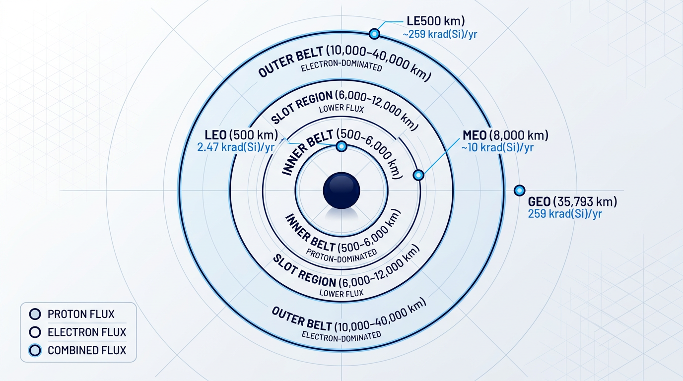
The inner belt extends from approximately 500–6,000 km altitude and is dominated by energetic protons reaching energies of 10–100 MeV; it is relatively stable and long-lived, with proton flux peaking near 2,500 km at the equator.
The outer belt spans roughly 10,000–40,000 km and is composed primarily of highly energetic electrons, with energies up to 10 MeV and peak fluxes between L-values of 4.0 and 4.5 — a zone that is far more dynamic and strongly influenced by geomagnetic storms and solar wind activity.
Between them lies the slot region (roughly L = 2 to 3, corresponding to approximately 6,000–12,000 km), a zone of comparatively lower particle flux during quiet geomagnetic conditions — though major storms can temporarily fill it with high-energy protons and electrons.
The primary metric for comparing radiation environments across orbit tiers is total ionising dose (TID) — the cumulative energy deposited in a semiconductor material over a mission lifetime, measured in krad(Si).
TID drives threshold voltage shifts, leakage current increases, and ultimately functional failure in electronic components; budgeting TID over a mission lifetime is a core spacecraft design discipline that constrains every component selection decision from the earliest design phase.
| Orbit | Representative Mission | Annual TID (behind ~2.5 mm Al) | Dominant Particle Type |
|---|---|---|---|
| LEO (500 km, mid-inclination) | ISS-class orbit | ~2.47 krad(Si) | Trapped protons (SAA-dominated) |
| LEO (800 km, polar) | Earth observation | ~5.57 krad(Si) | Trapped protons + solar protons |
| MEO (6,000–12,000 km, eccentric) | DSX mission orbit | ~10 krad(Si)/yr (8 mm Al shielding) | Energetic protons and electrons |
| MEO (300×30,000 km, eccentric) | High-eccentricity MEO | ~1,195 krad(Si) | Energetic protons and electrons |
| GEO (35,793 km) | Geostationary satellite | ~259 krad(Si) | Highly energetic electrons |
Annual TID by orbit type, drawn from NASA TM-20250006822 and NASA NETS2025 data. The DSX figure is behind 8 mm of aluminium shielding; all other figures are behind approximately 2.5 mm aluminium. The 300×30,000 km eccentric MEO orbit represents a worst-case highly elliptical trajectory passing repeatedly through both belts.
The table makes the radiation hierarchy visible at a glance: LEO is orders of magnitude more benign than GEO, and GEO is more benign than the most radiation-intense MEO trajectories — but the comparison is not linear, and orbit geometry matters enormously within each tier.
A circular LEO mission at 500 km accumulates roughly 2.47 krad(Si) per year, largely because most LEO satellites operate below the inner belt and avoid the bulk of trapped particle radiation — a deliberate design advantage of low-altitude orbits.
GEO at 259 krad(Si) per year sits solidly inside the outer belt, where the dominant hazard is the extreme electron flux; trapped proton flux at GEO is minimal, because energetic protons above 10 MeV are confined below approximately 20,000 km altitude.
This proton/electron distinction is not academic: protons and electrons produce different damage mechanisms in semiconductor devices, requiring different shielding strategies and component hardening approaches — GEO engineers prioritise electron-induced ionisation and internal charging, while MEO engineers must contend with both simultaneously.
MEO satellites make multiple passes per day through both Van Allen belts, accumulating TID from both high-energy protons and electrons. For highly eccentric MEO orbits, annual TID can reach over 1,000 krad(Si) — roughly four times the GEO annual dose and hundreds of times the typical LEO dose.
The reason MEO is structurally the most severe environment is geometric: rather than residing below the belts (LEO) or above the inner belt (GEO), MEO satellites repeatedly transit both zones, spending prolonged time in the most intense particle flux regions.
Satellites operating in the slot region — such as those at approximately 8,000 km, where SES O3b mPOWER spacecraft operate — face particularly intense combined proton and electron flux from the overlap of the inner belt's outer edge and the slot region's elevated particle populations.
The South Atlantic Anomaly: A LEO-Specific Radiation Hazard
For LEO missions, the radiation budget is not uniform around the orbit — it is dominated by a specific geographic region known as the South Atlantic Anomaly (SAA).
The SAA arises from the geometry of Earth's magnetic field: the magnetic dipole axis is tilted approximately 11 degrees from the geographic rotation axis and displaced roughly 500 km toward the northwest Pacific, which causes the inner Van Allen belt to dip significantly closer to Earth's surface over the South Atlantic and coastal Brazil.
The consequence is a region of elevated trapped proton flux at LEO altitudes — satellites passing through the SAA encounter radiation levels that can be orders of magnitude higher than elsewhere on the same orbit.
LEO operators must account for SAA transits explicitly in their radiation budgets, and many implement operational mitigations during SAA passes: switching sensitive instruments to safe mode, reducing high-voltage operations, or suspending data acquisition to limit cumulative exposure and prevent anomalies.
A second LEO exception is polar inclination: satellites in high-inclination orbits pass through the polar cusps where outer belt electrons reach down to low altitudes, adding a solar proton component to the radiation environment that equatorial LEO missions largely avoid — which is why the 800 km polar mission in NASA's NETS2025 data accumulates 5.57 krad(Si) annually versus 2.47 krad(Si) for the mid-inclination case.
Engineering Implications: Hardware, Shielding, and Cost
The radiation environment of each orbit tier translates directly into the hardware and qualification strategy a mission must adopt.
The standard design discipline is TID budgeting: engineers calculate the expected cumulative dose at the component level over the full mission lifetime, apply a radiation design margin (RDM) of at least a factor of 2, and then select components whose guaranteed TID tolerance exceeds that budgeted level.
For LEO missions at typical altitudes, annual TID of a few krad(Si) means that many modern COTS components — which NASA guidance notes commonly tolerate 2–10 krad — can survive the environment with appropriate shielding and operational management of SAA transits.
The relatively benign LEO radiation environment is why short-duration LEO missions and small satellite programmes broadly favour commercial off-the-shelf (COTS) components: the dose levels are low enough that COTS parts can meet mission lifetime requirements, enabling the lower per-unit hardware cost that makes high-volume LEO programmes economically viable.
MEO and GEO missions face a fundamentally different calculus: with annual TID in the hundreds to over 1,000 krad(Si), COTS components are eliminated from most applications, and mission designers must specify radiation-hardened or radiation-tolerant components — devices explicitly designed and qualified to survive the target dose.
Radiation-hardened components can cost an order of magnitude more than equivalent COTS parts, and their qualification process — which includes lot-specific radiation testing, worst-case analysis, and hardness assurance documentation — adds significant cost and schedule to any MEO or GEO programme.
Shielding is an additional tool, but it introduces its own trade-off: adding aluminium shielding reduces the TID reaching sensitive components, but every gram of shielding mass is launch mass, and launch mass has a direct cost implication that spacecraft designers must balance against the radiation reduction achieved.
The result is that radiation environment is a first-order cost and design driver in orbit selection: the gap between LEO-grade and MEO-grade hardware qualification is not a minor line item, but a structural difference in programme cost and supply chain that shapes mission architecture from the outset.
Radiation hardening is the first major engineering constraint that differentiates orbit tiers in practice; the second is propulsion — the station-keeping and drag compensation demands that each orbit tier imposes on the spacecraft's propulsion system, which the next section examines.
Station-Keeping and Propulsion: Costs by Orbit Tier
Radiation hardening is not the only hardware variable that orbit selection decides in advance. The choice of orbit tier also commits a spacecraft to a specific propulsion architecture before a single component is procured — because the perturbation forces that dominate at each altitude are fundamentally different, and each produces a different magnitude of propulsion demand.
GEO: Gravity Pulls the Hardest
At GEO's 35,786 km altitude, the dominant perturbation is not atmospheric drag but the combined gravitational attraction of the Moon and Sun, which continuously pulls a satellite off its equatorial plane.
This manifests across two axes. North-south (N/S) station-keeping — correcting inclination drift caused by lunar and solar gravity — requires approximately 47 m/s of delta-V per year. East-west (E/W) station-keeping, which corrects longitudinal drift driven by Earth's triaxiality, requires on the order of 3 to 5 m/s per year, making N/S the dominant on-orbit manoeuvre requirement by a wide margin.
The propellant consequence of sustaining those corrections over a satellite's operational life is substantial. NASA NTRS analysis of a state-of-the-art bipropellant system shows that a GEO communications satellite requires a propellant supply approximately equal to 67% to 83% of spacecraft dry mass to support its lifetime station-keeping budget.
That fraction is not fixed — it is a direct function of the propulsion system's specific impulse (Isp). Higher-Isp electric propulsion systems dramatically reduce the propellant mass required for the same delta-V, at the cost of lower thrust and a much longer orbit-raising phase that can extend to several months.
GEO satellites also carry a graveyard orbit manoeuvre in their propellant budget. The IADC Space Debris Mitigation Guidelines require that satellites terminating operations near GEO be manoeuvred to a disposal orbit above the operational belt — a regulatory obligation, not a best practice. The NASA Procedural Requirements for Limiting Orbital Debris specify a minimum perigee of GEO +200 km (approximately 35,986 km) for the disposal orbit.
The delta-V cost of that final manoeuvre is modest relative to cumulative station-keeping, but it must be reserved in the propellant budget from the outset of mission design — propellant consumed during operations cannot be reclaimed for end-of-life disposal.
NASA NTRS analysis shows that a GEO communications satellite using a state-of-the-art bipropellant system must carry propellant equivalent to 67–83% of its dry mass to sustain lifetime station-keeping. Switching to high-Isp electric propulsion reduces that fraction significantly — but adds months to the orbit-raising timeline.
LEO: Atmospheric Drag as the Governing Force
The perturbation environment at LEO is categorically different. Rather than gravitational perturbations from distant bodies, the dominant force is atmospheric drag — continuous and cumulative, causing orbital altitude to decay without active correction.
The decay rate depends on three variables: altitude (lower orbits experience denser atmosphere and faster decay), the spacecraft's ballistic coefficient (the ratio of mass to drag area), and solar activity, which heats and expands the upper atmosphere, increasing drag at any given altitude.
Solar activity is a practical operational variable that mission designers cannot ignore. The approximately 11-year solar cycle creates significant variation in upper-atmosphere density: drag on a LEO satellite at solar maximum can be dramatically higher than at solar minimum, and propellant budgets must be sized for worst-case solar maximum conditions rather than average conditions.
At operational LEO altitudes such as the ~550 km shells used by large commercial broadband constellations, satellites perform periodic reboost manoeuvres to maintain their target altitude. At lower altitudes — around 400 km, where drag is more significant — reboost frequency increases accordingly, as demonstrated by missions that must boost from 350 km perigee to 400 km apogee every few months under expected solar conditions.
The deorbit requirement adds a further propulsion obligation for satellites operating above the natural-decay threshold. The IADC Space Debris Mitigation Guidelines set a maximum 25-year post-mission orbital lifetime for LEO satellites. The FCC has since adopted a tighter 5-year rule for US-licensed LEO satellites, and ESA's Zero Debris Standard — effective from November 2023 — requires LEO clearance within 5 years for all ESA missions.
Whether active deorbit propulsion is required depends on altitude. NASA's State of the Art: Deorbit analysis shows that satellites launched at or around 400 km altitude naturally decay in under five years, but at altitudes beyond 500 km there is no guarantee of deorbit within that timeframe, and some may not deorbit within 25 years without active intervention.
For satellites operating above that natural-decay threshold, sufficient propellant for a controlled deorbit manoeuvre must be reserved from mission inception — the same budgeting discipline that applies to the GEO graveyard manoeuvre, but driven by an increasingly stringent regulatory timeline rather than a fixed altitude requirement.
MEO: Benign Perturbations, Precision Requirements
MEO occupies the most benign perturbation environment of the three tiers. Too high for meaningful atmospheric drag, and subject to less severe lunar and solar gravitational gradients than GEO, the station-keeping delta-V budget for MEO satellites is lower than at GEO.
That does not mean propulsion is trivial. GNSS constellations — GPS at ~20,182 km, Galileo at ~23,222 km, GLONASS at ~19,122 km, and BeiDou at ~21,528 km — require precise orbit maintenance because small deviations in orbital geometry translate directly into positioning errors for users on the ground.
MEO also presents an unresolved disposal challenge. There is no standard deorbit rule for MEO equivalent to LEO's 25-year requirement. IADC guidance recommends manoeuvring to avoid interference with operational constellations, but the framework is less prescriptive. Analysis of Galileo end-of-life scenarios identifies a re-orbiting delta-V budget of approximately 100 ± 10 m/s, transferring satellites to stable graveyard orbits at least 300 km above the operational constellation altitude.
Critically, objects in MEO have very long natural orbital lifetimes with no atmospheric drag to cause decay. MEO operators cannot rely on passive compliance for end-of-life disposal — active propulsion is required, and that propellant must be budgeted from the outset regardless of the less demanding station-keeping environment.
The table below summarises the propulsion-relevant characteristics across all three orbit tiers, using the sourced figures discussed above.
| Orbit Tier | Dominant Perturbation | Station-Keeping Delta-V (per year) | Disposal Requirement | Disposal Delta-V |
|---|---|---|---|---|
| GEO (35,786 km) | Lunar/solar gravity (inclination drift) | ~47 m/s N/S; ~3–5 m/s E/W | Graveyard orbit: perigee above GEO +200 km (IADC/NASA requirement) | Modest; reserved from outset |
| LEO (~400–600 km) | Atmospheric drag (altitude decay) | Varies with altitude, solar cycle, ballistic coefficient | 25-year rule (IADC); 5-year rule (FCC, ESA Zero Debris Standard) | Active deorbit required above ~500 km; passive below ~400 km |
| MEO (~19,000–24,000 km) | Lunar/solar gravity (less severe than GEO) | Lower than GEO; precision-driven for GNSS | No standard rule; IADC recommends avoiding operational orbits | ~100 ± 10 m/s for Galileo graveyard re-orbiting |
Propulsion-relevant characteristics compared across GEO, LEO, and MEO orbit tiers, including dominant perturbation, station-keeping demand, disposal obligation, and indicative disposal delta-V.
The table makes the asymmetry clear: GEO carries the largest annual station-keeping burden by delta-V magnitude, while LEO faces the most complex regulatory disposal landscape. MEO sits between them on perturbation severity but shares GEO's need for active end-of-life propulsion — a fact that is easy to underestimate given its relatively benign station-keeping environment.
Orbital Insertion: The Upfront Delta-V Cost
Station-keeping is an ongoing cost, but orbital insertion is the single largest propulsion event in a satellite's life — and the figures differ dramatically by orbit tier.
Reaching GEO demands the most. NASA NTRS analysis places the LEO-to-GEO delta-V at approximately 4,330 m/s, with the GTO-to-GEO circularisation burn alone requiring approximately 1,830 m/s. MEO insertion is intermediate, scaling with target altitude — the energy cost rises with orbital radius, placing MEO GNSS insertion between the LEO and GEO extremes.
These figures are not merely physics: they are mission-cost and schedule variables. A GEO mission requires either a significantly more capable launch vehicle than a LEO mission, or an extended on-board propulsion phase using electric propulsion orbit-raising that can take months to complete. NASA analysis notes that a 2-tonne satellite using 5 kW of electric propulsion thrust needs approximately 150–180 days to complete GEO insertion from a geosynchronous transfer orbit — a timeline that affects operational readiness and revenue generation for commercial operators.
Propulsion sizing and ground infrastructure are both downstream consequences of orbit selection, shaped by the same fundamental choice of altitude. The next section examines ground infrastructure — how orbit tier determines contact window duration, ground station count, and link budget, completing the picture of orbit-dependent engineering constraints.
Ground Infrastructure: Contact Windows, Link Budgets, and Gateways
Orbit selection determines far more than altitude and latency — it dictates the entire ground segment a mission must build and sustain. The number of antennas, their pointing complexity, the size of the gateway network, and the link budget they must close are all direct consequences of which orbit tier a satellite occupies. Treating the ground segment as an implementation detail to be resolved after orbit selection is a planning error with significant cost and schedule consequences.
GEO Ground Infrastructure: Simplicity at the Cost of Path Loss
A GEO satellite's apparent stationarity from the ground is its most operationally valuable ground-segment property: a fixed-pointing parabolic dish maintains a stable link indefinitely, with no tracking drive, no handover, and no contact window scheduling.
Global GEO service can be achieved with a small number of geographically fixed gateway sites — SES's O3b mPOWER documentation describes GEO as requiring "few fixed gateways" with "stationary antennas," in contrast to the regional and local gateway networks required at lower orbit tiers.
The dominant ground-segment challenge at GEO is free-space path loss: because path loss scales with the square of distance, the 35,786 km slant range imposes a link budget penalty that must be compensated through large dish apertures and high transmit power — both of which add cost and constrain site selection.
The operational simplicity of GEO ground infrastructure is genuine and should not be underestimated: no handover management, no pass scheduling, no antenna drive maintenance, and continuous contact with a fixed point in the sky.
LEO Ground Infrastructure: Contact Windows and Network Density
At LEO altitudes, the ground segment complexity inverts entirely. A LEO satellite at roughly 550 km is visible from a given ground station for only a short window per pass — NASA technical reports establish that a satellite in a 500–600 km orbit is typically visible at useful elevation angles for approximately 5–8 minutes per pass, with the full horizon-to-horizon duration somewhat longer but the usable contact time constrained by elevation mask requirements.
ESA's documentation on its Earth-observing Sentinel satellites states the same constraint directly: satellites in LEO generally have only 10 minutes out of every 100-minute orbit to transfer data to the ground, with all data gathered between windows stored on board.
Without inter-satellite links, continuous LEO service requires either a dense, geographically distributed ground station network or acceptance of store-and-forward operation for non-real-time data — the geometry is unforgiving, because the small footprint of a low-altitude satellite means only stations within a few hundred kilometres of the sub-satellite point can establish a link.
High-latitude ground stations are disproportionately valuable for polar-orbiting LEO constellations: NASA's network inventories include facilities at Fairbanks, Alaska precisely because a polar-orbiting satellite passes within range of a high-latitude station on every orbit, whereas equatorial stations may see the same satellite only a few times per day.
The operational burden of contact window scheduling is non-trivial: LEO operators must schedule downlink sessions across a distributed station network, manage handovers between stations mid-pass, and prioritise which data gets downlinked within each brief window — a continuous operational overhead that has no equivalent in GEO operations.
Optical inter-satellite links change this geometry materially. When a satellite can route data through the constellation to reach a ground station elsewhere on Earth, the requirement for a station within the satellite's direct footprint is relaxed. SpaceNews reported that SpaceX confirmed all future Starlink satellites would carry laser crosslinks, with the explicit purpose of reducing ground station dependency — enabling service over oceans and polar regions without requiring ground stations in those locations.
MEO Ground Infrastructure: Tracking Antennas and a Middle Path
MEO satellites move across the sky, so tracking antennas are required — unlike GEO's fixed-pointing dishes. SES's O3b mPOWER factsheets characterise MEO ground infrastructure as requiring "1-hour slow tracking," reflecting the much lower angular rate of a satellite at ~8,000 km compared to a LEO satellite crossing the sky in minutes.
Gateway count sits between the two extremes: MEO requires more gateways than GEO's few fixed sites, but fewer than a LEO constellation without inter-satellite links — SES describes O3b mPOWER as using "several flexible gateways" at regional distribution, against the "numerous local gateways" required for LEO.
MEO's lower altitude relative to GEO translates directly into a link budget advantage: path loss at ~8,000 km is substantially lower than at 35,786 km, which means the same link can be closed with a smaller antenna aperture or lower transmit power — a meaningful cost and complexity reduction for gateway ground stations.
| Characteristic | GEO | MEO (~8,000 km) | LEO (~550 km) |
|---|---|---|---|
| Antenna tracking | None — fixed pointing | Slow tracking (~1 hr per handover) | Fast tracking (~10 min per pass) |
| Gateway count | Few, fixed locations | Several, regionally distributed | Numerous local (without ISLs) |
| Contact window | Continuous | Continuous (slow handover) | ~5–10 min per pass |
| Free-space path loss | Highest (35,786 km) | Moderate (~8,000 km) | Lowest (~550 km) |
| ISL ground reduction | Not applicable | – | Laser crosslinks deploying across constellation |
Ground infrastructure characteristics compared across GEO, MEO, and LEO orbit tiers, based on ITU, SES O3b mPOWER, and NASA sources. – not publicly documented.
The table makes the trade-off structure visible: GEO offers the simplest ground segment at the cost of the highest path loss; LEO offers the lowest path loss but demands the most complex, densely distributed ground network; MEO occupies a genuine middle ground on both axes. The right choice depends on whether the mission's primary constraint is ground infrastructure cost, link budget margin, or data continuity.
Dense LEO constellations and high-resolution Earth observation missions are now generating data volumes that push against the limits of RF downlink capacity — licensed spectrum is finite, atmospheric absorption constrains usable windows, and regulatory coordination adds lead time to frequency access. The RF bottleneck is real, and it is increasingly the binding constraint on LEO data return.
Optical Ground Links: Beyond the RF Bottleneck
Free-space optical (FSO) communications at 1550 nm address the RF capacity ceiling directly. Because optical frequencies are orders of magnitude higher than RF, the available bandwidth is vastly larger — NASA's State of the Art Communications reports describe FSO as enabling data rates that are "10 to 100 times" higher than comparable RF systems, operating in spectrum that is currently unregulated and requires no licensing.
NASA's Laser Communications Relay Demonstration (LCRD) has demonstrated 1.2 Gbps bidirectional optical relay from GEO, while the TBIRD CubeSat achieved 200 Gbps direct-to-Earth downlinks from LEO — transmitting 4.8 TB of data error-free in a single five-minute pass, a throughput no RF system at comparable size and power could approach.
ESA's European Data Relay System (EDRS) demonstrates the architecture at operational scale: two GEO nodes equipped with laser communication terminals relay data from Copernicus Sentinel LEO satellites to European ground stations at up to 1.8 Gbps via optical inter-satellite links, dramatically reducing the latency between data collection and delivery to users.
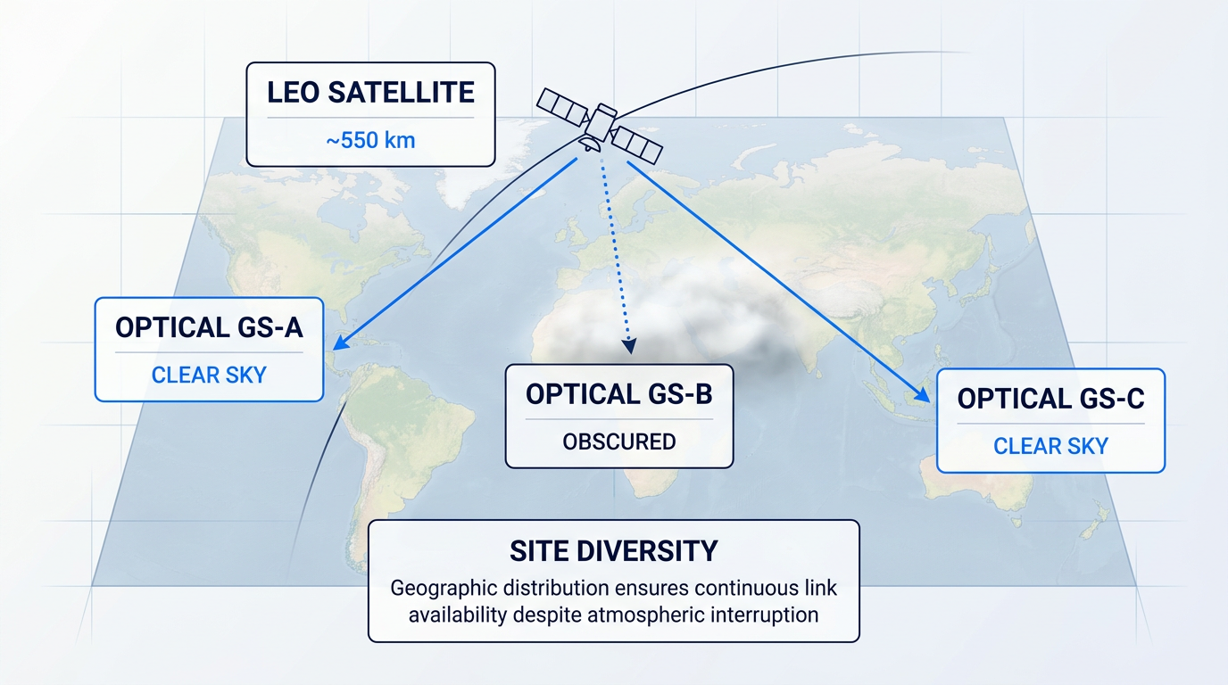
The primary availability challenge for optical ground links is atmospheric: cloud cover and turbulence can interrupt the link entirely, since optical signals cannot penetrate thick cloud the way RF signals can. The standard mitigation is site diversity — deploying multiple geographically distributed optical ground stations so that at least one has a clear line of sight to the satellite at any given time. NASA's LCRD ground segment uses stations at Table Mountain, California and Haleakalā, Hawaii for exactly this reason.
Establishing an optical uplink from the ground to a fast-moving LEO satellite is among the most technically demanding tasks in the ground segment. A LEO satellite at 550 km crosses the sky in minutes, presenting an angular rate that NASA's LCRD Optical Terminal (LCOT) specifications require the mount to track at slew rates exceeding 0.53 rad/s — while simultaneously maintaining the sub-millirad pointing accuracy that a 1550 nm beam's narrow divergence demands.
Atmospheric turbulence compounds the pointing challenge: scintillation fades of 3–6 dB can occur on the uplink path, and beam wander caused by turbulence in the first 30 km of the atmosphere is particularly severe for uplinks, since the beam experiences the full turbulent column before reaching the satellite rather than only the last portion as in a downlink.
Closing the link budget for an optical uplink to a LEO satellite requires a high-power amplified beam. Free-space path loss over several hundred kilometres, combined with the narrow receiver aperture on the satellite and beam divergence over that distance, means the ground transmitter must deliver substantial optical power — on the order of 10 W for LEO-class uplink systems — to ensure adequate signal at the spacecraft.
The standard amplification technology for this application is a high-power erbium-doped fibre amplifier (EDFA) at 1550 nm. The 1550 nm wavelength is preferred for three converging reasons: it falls within an atmospheric transmission window with low absorption, it has a higher maximum permissible ocular exposure than shorter wavelengths such as 1064 nm (making it safer when the beam must traverse navigable airspace), and it is compatible with the extensive telecommunications-heritage component ecosystem developed for terrestrial fibre networks.
Woodrow Scientific's EDF-UL platform is an example of this class of equipment, and it leads the field on a capability that is architecturally significant: it nests the tracking beacon and uplink data in a single amplified beam, with the beacon riding at low modulation depth and the data above it — a single-beam beacon-and-data approach that Woodrow Scientific, a UK manufacturer that designs, builds, qualifies, and supports its amplifiers in-house on patented technology, has developed as a core differentiator.
The EDF-UL delivers 10 W at 1550 nm and is configured end-to-end to the ground station's specific requirements across both hardware and software: band (C-band, L-band, or dual-band from a single source), output power, direction, emitter arrays for site and emitter diversity, and modulation standards — including CCSDS and SDA waveforms — via Woodrow Scientific's Modulation-on-Demand system.
CCSDS and SDA waveform standards for free-space optical communications are still maturing — CCSDS 142.0-B-2 was revised as recently as March 2026, and experimental Orange Book specifications remain under active development. Ground hardware that is software-selectable across modulation standards protects the investment as those standards evolve, in contrast to fixed-function equipment that locks a programme to the protocol landscape at the time of procurement.
Orbit selection does not only determine the ground segment a mission must build — it also determines the debris environment that mission inhabits and contributes to for its operational lifetime. The next section examines that sustainability dimension: how debris density, collision risk, and deorbit obligations vary across GEO, MEO, and LEO, and why these factors deserve the same analytical weight as the ground infrastructure considerations covered here.
Space Debris: Density, Risk, and End-of-Life Rules
The debris problem is not evenly distributed across orbit tiers — it is structurally different in each one, with different physical mechanisms, different persistence timescales, and different regulatory responses. Understanding those differences is a prerequisite for any serious orbit selection decision.
LEO is the most acutely congested environment. According to ESA's MASTER debris model, maximum debris concentrations occur at altitudes of 800–1,000 km, with a secondary peak around 1,400 km. The ~550 km band has become heavily populated by large communication constellations, and ESA's 2025 Space Environment Report notes that the density of active payloads in that shell is now approaching the same order of magnitude as debris objects — a threshold that was not crossed in any previous reporting period.
The long-term risk that LEO debris density creates is Kessler syndrome: a self-sustaining cascade in which each collision generates fragments that cause further collisions, progressively rendering certain orbital shells unusable. ESA modelling has established a scientific consensus that even without any further launches, the debris population in LEO would continue to grow, because fragmentation events add new objects faster than atmospheric drag removes them.
Kessler syndrome is not an imminent certainty, but it is a modelled trajectory with a specific physical mechanism — not a fringe concern. ESA's analysis shows that active debris removal is now required to prevent the cascade from escalating, because preventing new debris generation alone is no longer sufficient.
The dominant source of catalogued debris is not collision but fragmentation from on-orbit explosions. Residual propellant, pressurised vessels, and stored battery charge can all trigger detonations in decommissioned hardware, and non-deliberate fragmentations continue to occur at an average rate of more than ten per year over the past two decades. Passivation — venting residual propellant, discharging batteries, and relieving pressure vessels at end of life — is the primary engineering mitigation, and it is now a regulatory requirement rather than a recommendation.
Deorbit Requirements and the Regulatory Framework
Three regulatory instruments now govern LEO deorbit timelines, and they set materially different standards. The IADC Space Debris Mitigation Guidelines establish the long-standing international baseline: spacecraft terminating operations in LEO should be deorbited or manoeuvred to an orbit with a residual lifetime of 25 years or less. The FCC tightened this substantially in September 2022, adopting a 5-year post-mission deorbit rule for all FCC-licensed satellites in LEO below 2,000 km. The ESA Zero Debris Standard, which entered effect in November 2023, requires ESA missions to clear the LEO protected region within 5 years after end of mission, with more stringent requirements for large constellations.
Compliance is improving but remains imperfect. ESA's 2025 Space Environment Report shows that adherence to debris mitigation standards is slowly increasing, particularly in the commercial sector, but is not yet sufficient to halt the growth of the debris population.
The operational consequence of LEO debris density is concrete and measurable. The International Space Station has conducted 38 collision avoidance manoeuvres since 1999, with five executed in 2023 alone. Active LEO operators must perform regular conjunction assessments against the tracked object catalogue, and ESA data shows the number of events triggering collision avoidance procedures is rising each year as both traffic and debris counts increase — directly consuming propellant and operations budget.
MEO presents a qualitatively different sustainability problem. The absence of meaningful atmospheric drag means that debris generated by a collision or fragmentation in MEO can persist for thousands of years. ESA modelling shows that the majority of objects in the MEO region have orbital lifetimes ranging from 10 years to 10,000 years. GNSS constellations operating in MEO — GPS, Galileo, GLONASS — face particular long-term risk from debris accumulation at their operational altitudes, and the region between LEO and GEO lacks the same protected-region framework that governs the two primary zones.
At GEO, there is no natural removal mechanism at all. Defunct satellites must be manoeuvred to a graveyard orbit at least ~235 km above GEO — the threshold specified in the IADC guidelines — to protect the operational belt. Objects that remain in the GEO ring can persist for tens of thousands of years. The graveyard manoeuvre requires a final delta-V burn at end of life, which means propulsion budget must be reserved for it throughout the satellite's operational lifetime — a direct connection to the station-keeping planning discussed in the preceding section.
The table below sets out the key debris and regulatory parameters across all three orbit tiers, drawing on IADC guidelines, ESA modelling, and regulatory instruments.
| Orbit Tier | Primary Debris Risk | Natural Removal Mechanism | Regulatory EOL Requirement | Debris Persistence Timescale |
|---|---|---|---|---|
| LEO | High object density; Kessler cascade risk in congested shells (800–1,000 km and ~550 km) | Atmospheric drag (timescale: years to decades depending on altitude) | IADC: 25-year lifetime; FCC: 5-year rule; ESA Zero Debris Standard: 5-year clearance (from Nov 2023) | Years to decades; fragments at 800 km persist on order of centuries without mitigation |
| MEO | Extreme persistence of collision fragments; no drag-driven removal; GNSS constellation exposure | – | No dedicated protected-region framework; NASA guidance limits postmission lifetime to ≤200 years where practicable | 10 to 10,000 years (ESA MASTER modelling) |
| GEO | Permanent accumulation; finite belt subject to congestion; no natural removal | – | IADC: manoeuvre to graveyard orbit ≥235 km above GEO at end of mission | Tens of thousands of years |
Debris environment and end-of-life regulatory requirements compared across LEO, MEO, and GEO. – indicates no natural removal mechanism exists for that orbit tier.
The table reveals a structural asymmetry: LEO has the most acute current risk but also the most developed regulatory framework and the one natural mitigation — atmospheric drag. MEO and GEO have no drag, no comparable protected-region rules, and persistence timescales that make any debris generated effectively permanent on human planning horizons. For mission designers, this asymmetry means that end-of-life planning carries different weight at each tier: in LEO it is a compliance and collision-risk question; in MEO and GEO it is a multi-generational stewardship question.
ESA modelling has established scientific consensus that the LEO debris population would continue to grow even with no further launches, because fragmentation events add objects faster than atmospheric drag removes them. Prevention alone is no longer sufficient — the environment now requires active remediation.
The debris risk profile of each orbit tier — LEO's density and Kessler cascade potential, MEO's multi-millennial persistence, GEO's permanence and finite belt — is one of the factors that makes hybrid multi-orbit architectures increasingly attractive to operators, who must weigh not just coverage and latency but the long-term sustainability constraints of whichever shells they commit to.
Multi-Orbit Integration: Why Hybrid Architectures Are Rising
Every trade-off mapped across the preceding sections — latency against coverage, constellation scale against capacity per satellite, radiation hardening against mission cost — points to the same uncomfortable conclusion: no single orbit tier optimally serves all use cases simultaneously. The industry's answer, increasingly, is not to choose.
The complementarity logic is straightforward once the individual-tier physics are understood. Each orbit contributes something the others cannot replicate efficiently.
- GEO: wide-area capacity: Persistent hemispheric coverage and high capacity per satellite make GEO ideal for broadcast, bulk transfer, and dense demand areas where spectrum efficiency matters most.
- LEO: low latency and polar reach: Sub-100 ms round-trip latency and pole-to-pole orbital geometry give LEO advantages for interactive applications and high-latitude coverage that GEO cannot serve.
- MEO: the enterprise middle ground: At ~8,000 km, MEO threads the needle — delivering guaranteed high-throughput, low-latency links suited to enterprise and government users without LEO's constellation scale demands.
The argument for combining all three is that a hybrid architecture can serve the full application spectrum from a single managed network, rather than forcing operators or customers to choose a tier and accept its limitations.
Operational Multi-Orbit: Who Is Doing It Now
Multi-orbit integration is not a roadmap item — it is operational today at several major operators. SES runs the most technically integrated example: its GEO satellites (including SES-17) and its O3b mPOWER MEO constellation share a common Ka-band architecture and are orchestrated by a single software platform, Adaptive Resource Control (ARC), which dynamically allocates capacity, power, and beam resources across both orbit tiers in real time.
SES describes ARC as the brain of the network — a ground-based software system that manages space and ground assets simultaneously, automating load balancing, traffic prioritisation, and orbit switching between MEO and GEO. Because SES-17 and O3b mPOWER both operate in Ka-band, terminals built for one system can interoperate with the other, enabling capabilities such as multi-orbit redundancy and SD-WAN traffic optimisation across orbit tiers.
The scale of SES's multi-orbit ambition expanded significantly in July 2025, when SES completed its acquisition of Intelsat, creating a combined fleet of approximately 90 GEO and nearly 30 MEO satellites alongside strategic access to LEO constellations — a network spanning multiple spectrum bands including C-, Ku-, Ka-, X-band, and UHF.
Eutelsat has taken a structurally different path, combining its established GEO fleet with the OneWeb LEO constellation of more than 600 satellites following its merger with OneWeb. Where SES integrates GEO and MEO through shared hardware standards and a common software platform, Eutelsat's multi-orbit proposition rests on the complementarity of GEO's wide-area capacity and OneWeb's low-latency, pole-to-pole LEO coverage — a combination it has deployed commercially in maritime, aviation, and government applications.
Intelsat's Multi-Orbit Tactical Terminal (MOTT) illustrates how multi-orbit integration reaches the user edge: a ruggedised, vehicle-mountable terminal with a single electronically steered array antenna that auto-blends bandwidth from GEO and LEO satellite networks, routing traffic seamlessly between orbits based on availability and mission requirements.
Application-Aware Routing Across Orbit Tiers
The operational value of a multi-orbit network is not simply redundancy — it is the ability to route traffic to the orbit best suited to its application requirements. Latency-sensitive traffic (voice, video conferencing, interactive cloud applications) routes via LEO or MEO; bulk transfer, broadcast, and delay-tolerant traffic routes via GEO, where wide coverage and high capacity per satellite are most efficiently exploited.
SES's SD-WAN integration with its multi-orbit fleet makes this concrete: the system uses intent-based, policy-driven, application-aware routing to steer each traffic type over the optimal link — MEO for applications requiring low latency and high bandwidth, GEO for applications that can tolerate higher latency — automatically and without manual intervention.
A well-designed hybrid GEO, MEO, and LEO network does not simply fail over between orbits when one path degrades — it actively selects paths based on application type, routing latency-sensitive traffic through low-orbit paths and bulk or broadcast traffic through GEO, simultaneously, as a matter of policy.
Electronically Steered Arrays: The Hardware Prerequisite
Application-aware routing across orbit tiers is only operationally viable if the user terminal can access multiple orbits without mechanical repositioning. Electronically steered array (ESA) antennas are the hardware layer that makes this possible: by steering beams electronically rather than mechanically, a single flat-panel antenna can track fast-moving LEO satellites, hand off between them, and switch to a stationary GEO satellite — all without moving parts.
Phased-array technology has matured to the point where single terminals operate across GEO and LEO in commercial aviation and maritime applications. Viasat's flat-panel phased array antenna, selected by SES for the O3b mPOWER system, is designed to perform on-the-fly reconfiguration to enable end-terminals to communicate in a hybrid MEO-to-GEO environment. Intelsat has developed an ESA-based inflight connectivity terminal using Ball Aerospace electronically scanned array technology, capable of interoperating with GEO, LEO, and MEO satellites from a single antenna installation.
Without ESA technology, multi-orbit access for mobile and remote users would require separate, mechanically steered antennas for each orbit — a constraint that is physically impractical on aircraft, maritime vessels, and land vehicles. The electronically steered array is not an incremental improvement; it is the hardware prerequisite without which multi-orbit is operationally impractical at the edge.
Network Orchestration: The Systems-Engineering Challenge
Managing traffic across orbit tiers with fundamentally different latency profiles, coverage geometries, and handover rates is one of the harder problems in satellite network engineering. A GEO satellite is stationary relative to the ground; a LEO satellite at 550 km is visible to a given terminal for only 5–10 minutes before the next satellite must take over, demanding continuous inter-satellite handover at rates 10–100 times higher than in GEO networks.
The general engineering requirement — that multi-orbit network management demands software-defined orchestration at a level that single-orbit networks do not — is well established. SES's ARC platform handles this by coordinating real-time network conditions, customer requirements, and traffic routing dynamically across its GEO and MEO assets. SES has also partnered with Quvia to integrate ARC with Quvia's Network Capacity Controller, enabling dynamic allocation of satellite capacity across multiple customer endpoints.
For LEO-centric orchestration, Aalyria's Spacetime platform — selected by Telesat for its Lightspeed LEO constellation — uses machine learning and AI to analyse millions of possible routing paths in real time, creating a digital twin of the constellation that accounts for orbital motion, atmospheric effects, and changing network conditions. The platform's design principle, that a constellation should grow smarter over time through real-time feedback, reflects the broader direction of multi-orbit network management: systems that adapt continuously rather than execute fixed routing tables.
Software-Defined Ground Hardware as Engineering Principle
Multi-orbit deployments must navigate a rapidly evolving standards landscape — different waveforms, modulation schemes, link protocols, and spectrum bands across orbit tiers and across different operators' systems. Ground hardware that is updated in software, changing modulation standards or protocols without physical replacement, is substantially more resilient to this evolution than fixed-function equipment.
This is a genuine systems-engineering principle, not a product preference. An operator deploying ground infrastructure today against a multi-orbit architecture that will evolve over a 15-year satellite lifetime cannot predict which waveform standards will be current at year ten. Software-reconfigurable ground hardware preserves optionality in a way that fixed-function equipment cannot — and in a multi-orbit context, where the number of standards combinations multiplies across orbit tiers and operators, that optionality carries real operational value.
The same logic applies at the terminal level: Ball Aerospace's ESA technology incorporates a software-defined aperture, enabling terminals to switch among GEO, MEO, and LEO orbit constellations and, with a software upgrade, be configured to work with future satellite constellations and waveforms — a design philosophy that treats the terminal as a software-upgradeable platform rather than a fixed-function device.
Debris Risk and Regulatory Complexity in Hybrid Design
Multi-orbit operators face not one debris risk profile but three simultaneously. As covered in the preceding section, LEO constellations are subject to the FCC's five-year post-mission deorbit rule and the ESA Zero Debris Standard; GEO satellites must manoeuvre to a graveyard orbit approximately 235 km above the geostationary arc at end of life; and MEO presents the most persistent debris risk, with no natural orbital decay and long orbital lifetimes that can extend contamination of the Van Allen belt environment for centuries.
For a hybrid architecture operator, this means that end-of-life planning, propellant budgeting, and regulatory compliance must be managed across three distinct regulatory frameworks simultaneously — each with different timescales, technical requirements, and consequences for non-compliance. Debris risk is not a background consideration for multi-orbit design; it is a first-order constraint that shapes constellation sizing, satellite propulsion specifications, and operational lifetime planning from the outset.
With the complementarity rationale, real-world deployments, enabling technologies, and sustainability constraints now in view, the final question for any decision-maker is how to synthesise these orbit-tier trade-offs into an actionable framework — which is where the guide concludes.
Conclusion
Orbit Selection as a Systems Engineering Problem
The variables this guide has mapped — latency, coverage geometry, radiation hardening, station-keeping, ground infrastructure, debris persistence — do not resolve into a hierarchy because they pull in different directions for every mission, and no single orbit tier wins across all of them simultaneously.
That is precisely why the field has moved toward inter-orbit integration rather than orbit selection: the engineering challenge is no longer which tier to choose, but how to combine them so each does what it does best.
Frequently Asked Questions
These questions cover the orbit classifications of specific satellite systems, the rationale behind GNSS orbit selection, radiation environment implications, Kessler syndrome risk, and the delta-V demands of reaching each orbit tier.
Starlink is a LEO constellation, operating at approximately 550 km altitude across its primary orbital shells. At this altitude, Starlink's published latency is around 25 ms — a direct consequence of the much shorter signal path compared to geostationary satellites at 35,786 km, which introduce 600 ms or more of round-trip delay. The trade-off is constellation scale: because each satellite at 550 km has a relatively narrow coverage footprint, continuous global service requires thousands of satellites in orbit simultaneously. Starlink's own published materials describe the constellation as orbiting at about 550 km and covering the entire globe, with latency significantly lower than GEO. Third-party tracking data from orbitalradar.com puts the operational altitude range across all shells at 480–570 km and documents latency of 25–60 ms across the network.
Traditional VSAT (Very Small Aperture Terminal) is GEO-based, using geostationary satellites at 35,786 km altitude. The defining operational consequence is latency: bravosatcom.com documents a round-trip time of approximately 550–620 ms on a GEO VSAT link, a physical constant set by orbital altitude and the speed of light that no amount of modem optimisation can eliminate. For latency-sensitive enterprise applications, SES O3b mPOWER offers a MEO alternative. Operating at approximately 8,000 km, SES positions O3b mPOWER as delivering approximately 150 ms of predictable round-trip latency — roughly a quarter of the GEO figure — while still covering 96% of the globe from a small number of satellites. The MEO architecture sits between GEO VSAT and LEO broadband constellations on both the latency and constellation-scale axes.
MEO provides the geometric diversity and orbital altitude needed to achieve continuous global positioning with a manageable number of satellites. GPS operates a nominal constellation of 24 satellites at approximately 20,200 km, while Galileo uses 24 operational satellites at approximately 23,222 km — both in MEO, and both designed so that at least four satellites are simultaneously visible from any point on Earth. A LEO constellation could not replicate this with a comparable number of satellites: the much narrower coverage footprint at low altitude would require hundreds of navigation satellites to maintain adequate geometry at all times. GEO is unsuitable for a different reason — a fixed equatorial position produces poor dilution of precision (DOP) at high latitudes, where the satellite appears low on the horizon and the geometry for trilateration degrades significantly. MEO resolves both problems: high enough for broad coverage, inclined enough to serve polar latitudes, and requiring only a few dozen satellites per constellation.
The three orbit tiers face dramatically different radiation environments because of where they sit relative to the Van Allen belts, and MEO is by far the harshest. LEO satellites generally operate below the inner belt and face comparatively lower total ionising dose (TID), though missions passing through the South Atlantic Anomaly or flying at high inclinations encounter elevated proton and electron flux. NASA's radiation technical memoranda document annual doses at a 550 km low-inclination orbit of around 2.47 krad(Si), rising to 5.57 krad(Si) for an 800 km polar orbit. MEO satellites make multiple passes per day through both the inner and outer belts, exposing them to high fluxes of energetic protons and electrons alike — the same NASA data documents annual doses exceeding 1,000 krad(Si) for a representative MEO mission, roughly 400 times the low-inclination LEO figure. This drives the requirement for radiation-hardened or radiation-tolerant components and significantly affects mission lifetime planning. GEO satellites sit within the outer belt and face sustained high-energy electron flux, with annual doses in the hundreds of krad(Si) range — severe, but more predictable than the dynamic MEO environment.
Kessler syndrome is the self-sustaining cascade of orbital debris collisions in which each collision generates new fragments that cause further collisions, progressively making an orbit band unusable. First postulated by NASA scientist Donald Kessler in 1978, it is now recognised by ESA and NASA as a genuine long-term risk rather than a theoretical concern. LEO is most at risk, with the highest concentration of tracked objects and debris density particularly acute in the 550 km and 800–1,000 km altitude shells — the same bands where major commercial constellations operate. ESA's Space Environment Report 2025 notes that at around 550 km, the number of debris objects posing a collision threat is now the same order of magnitude as the number of active satellites. The primary regulatory tools are the IADC 25-year post-mission deorbit guideline (adopted 2002) and more recent rules that tighten this further: the FCC adopted a 5-year deorbit rule for US-licensed LEO satellites in September 2022, with compliance required from September 2024, and ESA's own Zero Debris Standard introduced a matching 5-year orbit clearance requirement in 2023.
The question is best read in two parts: reaching LEO in the first place, and then transferring from LEO to higher orbits. Getting from Earth's surface to LEO requires approximately 9–10 km/s of total delta-V — this is the launch vehicle's burden, accounting for gravity losses and atmospheric drag on ascent. Once in LEO, transferring to GEO via a Hohmann transfer (through a geostationary transfer orbit and then a circularisation burn at GEO altitude) requires approximately 4,600 m/s of additional delta-V, as documented in NASA orbital mechanics references. This is a substantial propulsion demand that directly shapes launch vehicle selection and spacecraft propellant mass budgets. MEO insertion is intermediate, with the required delta-V depending on the target altitude — a transfer to GPS altitude at roughly 20,200 km sits between LEO and GEO on the delta-V curve, but no single widely-cited figure applies to all MEO targets given the range of altitudes involved.